| Trail Info | Snow Report | Maps | Wildlife | Lakes | Search | |||
 |
||
Echo Lake in the Ruby Mountains |
||
|
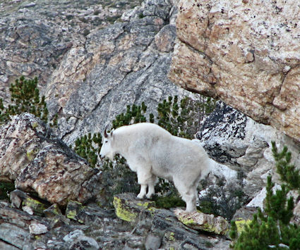
Echo Lake is the largest lake in the Ruby Mountains. It is 155 feet deep and 29 acres in size. Through the years I have seen Rocky Mountain Bighorn Sheep, Mountain Goats, Mule Deer and Beavers on this hike. I have heard pika around Echo Lake plus Himalayan Snowcock have been seen around Echo Lake also.
Fishing is usually great at this lake. Echo Lake has brook trout and is one of only two lakes in the Ruby Mountains to have Lake Trout. In July 2009 Jakob Ward caught a 33" Lake trout using a float tube that he carried in. The hike starts at the cattle guard on the road to Camp Lamoille. Then follow the road all the way through the camp until it ends. I have hiked this a few times and have only had one problem with the renters of Camp Lamoille letting me through. I would suggest letting them know you are on a trail and show them the signs, or have them escort you through it they are really disturbed.
I really like this section of the hike as it has lush vegetation with trees and beaver dams. There are service berry, wild raspberry, elderberry plus numerous flowers. I have not been able to find a selection of vegetation like this anywhere else in the Rubies. F ollow the trail up through the trees and vegetation and then it brakes into the upper half of Right Fork Canyon. Here you are confronted with an awesome view of Right Fork Canyon. This view is one of the best views in the Rubies. There are two ways to go from here. One is to follow the trail up along the left side of the stream. This is a good idea although there have been times that this section of the trail was very hard to find. Your second option is to cross the creek as soon as the canyon levels off and walk up the right side of the stream. Make sure you keep just high enough to stay out of the thick vegetation by the stream. The trail was marked very well this time so I followed it up the left side of the stream. The trail leads to a good spot to cross the stream. Cross the stream here and head up the canyon toward the next stream crossing. Eventually you will come to a fork in the stream. Cross the stream that comes from the right. This puts you at the start of the last hill before Goat Lake. This hill is easy to pull. Try to stay on top of the hill and follow the outside edge of the sage brush. Goat Lake is a very small lake that sets along the back of Right Fork Canyon. Hike around to the back of the lake and start the steep climb to the ridge between Right Fork and Box Canyon. I prefer to hike up to the left of the saddle between these two canyons.
As you stand on the ridge between these two canyons facing the small no name lake below, look toward the ridge to your right. There is a small pile of rocks and cliffs on this ridge, head toward the lower side of these rocks. Once you arrive at the ridge below the rocks head across to the next slope doing your best to keep your elevation the same. This part of the hike is on a steep slope of short sage brush and loose dirt. Keep your elevation the same the best you can until you come to the small cliffs to your right. This is the trickiest part of the hike. If you are too high and try to go through the steep rocky terrain you will have a very difficult time. The very steep slopes, loose rocks and dirt mixed with steep chutes and small cliffs make this a very difficult area to hike through. The best thing I have found to do is drop down below the cliffs and stay on solid ground. So drop down below the cliffs and keep heading toward Echo Lake. Stay as close to the bottom of the cliffs as you can and keep dropping down until you can start working your way back up to the saddle above Echo Lake. Once on the saddle above Echo Lake there is a great view of Echo Lake below. The first section is very steep once you drop off the saddle into Echo Lake. But after this short section it is easy to work your way down to the lake. There are places to camp by the mouth of the lake. There is also a sign at this end of the lake that shows the elevation of the lake, which is 9820 feet.
|
Download .KML for Google Earth Here.
This kml gives a 3D representation of the Ruby Mountains and this hike. When viewed in Google Earth there are more photos of the trail from me and other users. To the Trail Head: Drive up Lamoille Canyon and make a right turn at the sign to the Camp Lamoille. Follow the road over the bridge until the cattle guard. At the cattle guard there is a stop sign. Only authorized vehicles can proceed past this point. There is plenty of parking in the turn around by the cattle guard.
To view one of my earlier trip reports click Here . 
|